


Price
- No products in the cart.
-
-
-
specifications: [[item.skuinfo]]
price: [[item.currency]][[item.price]]
[[item.currency]][[item.allPrice]]
-
-
-
YOU MAY ALSO LIKE
[[item.currency]][[item.discount_price]] [[item.currency]][[item.price]]
ADD

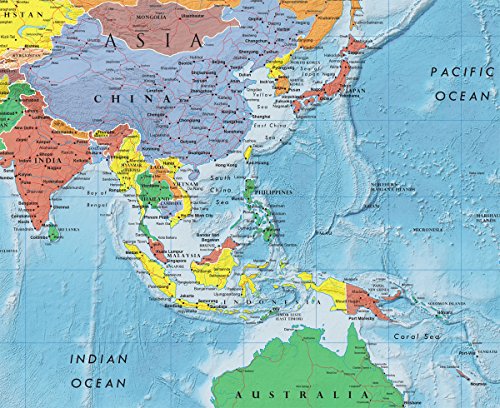
National Geographic Laminated World Wall Map (46 x 30.5 inches)
Revised Content:
National Geographic's World Maps: Setting the Highest Standard for Cartographic Excellence
Since publishing its first World Map in 1922, National Geographic has consistently excelled in the art and science of mapmaking. The publisher's unique cartographic style is defined by its distinctive features, including beautiful color palettes, proprietary typefaces, hand-drawn shaded relief, and meticulously researched content. This attention to detail and accuracy sets National Geographic's World Maps apart from the competition.
Each map is carefully compiled based on the latest data sources and independent verification of disputed boundaries, borders, and territories, ensuring the highest level of precision. When combined with exceptional design, the result is the best line of World Maps currently available.
Wall Map Formats: - Paper: High-quality matte poster stock, printed in the USA - Laminated: Plastic gloss lamination increases durability - Poster size: 24" x 36", designed to fit precut poster frames - Standard size: Approximately 30" x 46" - Enlarged size: Approximately 48" x 73 - Mural size: Approximately 77" x 110", comes as three panels that mount using wallpaper glue
Four Distinctive Styles: 1. Classic: The traditional National Geographic design featuring blue oceans with bathymetric contour steps, brightly-colored tint bands along country borders, and hand-drawn shaded relief. Presented in the Winkel Tripel projection. 2. Executive: An antique, earth-tone color palette combined with up-to-date cartography, making it a perfect match for home and office décor. Featuring bathymetric shading and the Winkel Tripel projection. 3. Decorator: The brightest of the National Geographic World Map designs, with solid colors filling each country, pale blue oceans with bathymetric shaded relief, and a black border. Presented in the Winkel Tripel projection. 4. Modern: A minimalist design showcasing the beautiful shape of the Earth's land mass in solid black, sitting on top of slate blue/gray oceans. Country names, borders, and major cities are displayed in contrasting white. Developed using the Times projection.
product information:
| Attribute | Value | ||||
|---|---|---|---|---|---|
| publisher | National Geographic Maps; 2021st edition (March 12, 2021) | ||||
| language | English | ||||
| map | 1 pages | ||||
| isbn_10 | 0792283090 | ||||
| isbn_13 | 978-0792283096 | ||||
| item_weight | 10.4 ounces | ||||
| dimensions | 3.25 x 3.25 x 37.5 inches | ||||
| best_sellers_rank | #42,903 in Books (See Top 100 in Books) #18 in World Atlases & Maps (Books) #27 in Geography (Books) #60 in United States Atlases & Maps (Books) | ||||
| customer_reviews |
|


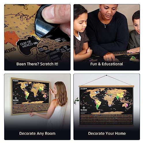


![Revised Title:
Laminated World and U.S. Map Poster Set - Wall Chart Maps Made in the USA [Black]](https://m.media-amazon.com/images/I/51pzjb8IAnL.jpg)